Un randonneur américain en France
My
Hike in France -
from the Italian Frontier
to the Atlantic coast
from the Italian Frontier
to the Atlantic coast
Soulac-sur-Mer << Agde
Agde << Italian frontier
<<<
<<< <<<
<<<
Hike direction: East to West <<<
<<< <<<
<<<
Above map (courtesy
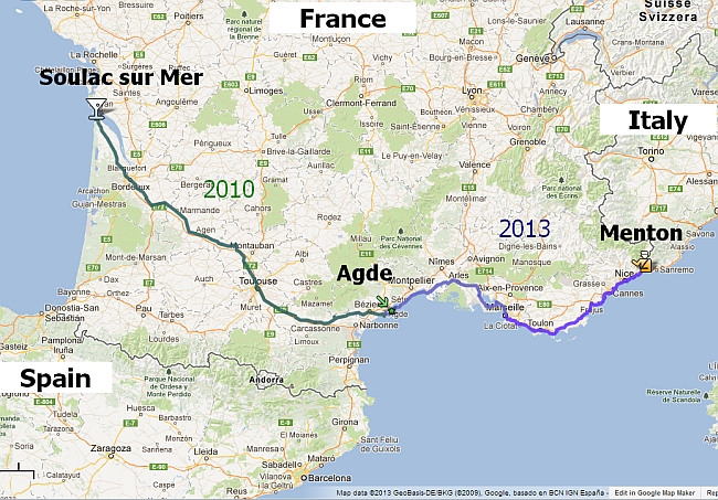
of Google Maps) shows my route of about 700 miles (1100 km).
In 2010, I started at Agde (middle) and hiked to Soulac-sur-Mer on the Atlantic coast (left).
In 2013, I resumed the hike at Menton (right), on the Italian frontier, and hiked to Agde (middle).
Click for a larger map. And here's a zoomable, scrollable one.
In 2010, I started at Agde (middle) and hiked to Soulac-sur-Mer on the Atlantic coast (left).
In 2013, I resumed the hike at Menton (right), on the Italian frontier, and hiked to Agde (middle).
Click for a larger map. And here's a zoomable, scrollable one.
Beta version, not for iPads
Let slideshow run - or control it
Contact me Introduction Part A index Part B index Slideshow My British hiking site
Except where stated, the contents of this site are © 2010-2013 Daryl May. Please write to me at daryl@mylongwalk.com to request permission to reproduce any part - or just to say hello.